Dania Idriss vient réaliser un stage de M1 dans le cadre du projet du défi-clé régional EaauCharb'Oc. Elle va notamment préparer le jeu de données du modèle PITCH portant sur le réseau hydrographique de l'aire d'alimentation de captage du Rieu, sur la commune de Paulhan.

Investigation des sols de l'Observatoire #OMERE à Roujan (34) par les Master 1 "Eau" @AgroParisTech @umontpellier ce 08 avril 2024. Recherche de "pépites" dans le sol pour illustrer leur célèbre effet en cours de géostatistique.


Ce week-end, le LISAH a été fièrement représenté au marathon en relais de Montpellier avec 2 équipes qui ont réussi l'effort dans une cohésion abasourdissante

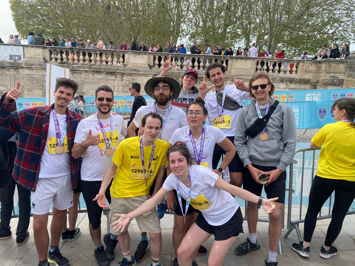
Remerciements à l'ADAS pour l'organisation qui a permis la participation de nombreuses équipes à la course 🙏
Norman FRANÇOIS, étudiant en 2e année d'informatique à l'IUT de Montpellier, va réaliser un stage de fin d'étude au LISAH : création d’une chaîne opérationnelle de traitement d’images pour le calcul de la densité apparente des sols par photogrammétrie

C'est aussi le début de stage d'Alfonso Jimenez de l'IUT de Montpellier, sur du dévelopmnt d'infrastructure informatique qui va aider à migrer de façon automatisée les services web de l'équipe @OpenFLUID , expérience potentiellement applicable plus largement dans l'unité #IaC
Le LISAH accueille Dorian Gerardin pour un CDD d'un an en développement logiciel #CPP afin d'aider l'équipe @OpenFLUID à développer, tester et maintenir la plateforme de modélisation 👨💻

Aujourd'hui commence le stage de M2 de Zoe Chastin au LISAH sur les bilans #hydrologiques actuels et futurs de la Communauté de Commune du Clermontais dans le cadre des living-Lab du défi clé régional WOC, bienvenue !

Invitation et participation du LISAH à la journée nationale organisée par le Syndicat Mixte des Gorges du Gardon et la Fédération Française des Professionnels de la Pierre Sèche le 23 mars.

Théorie et pratique sur le site de Castillon-du-Gard sur l'intérêt des ouvrages, dont ceux en pierre sèche, pour la #conservation des eaux et du sol en agriculture.

En début de semaine a été présenté un exposé sur "Rejuvenating Watersheds for Agricultural Resilience - Karnataka India" par Dr. R. Vasundhara, chercheuse Indienne en science du sol au NBSS&LUP à Bengalore, et qui est en accueil au LISAH-Montpellier pour 15 jours